Harvard Map Collection
Collections and support services
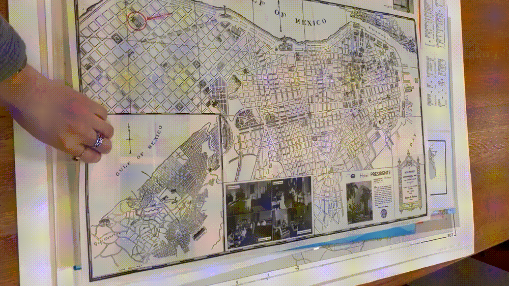 Historic maps of Havana in the Harvard Map Collection
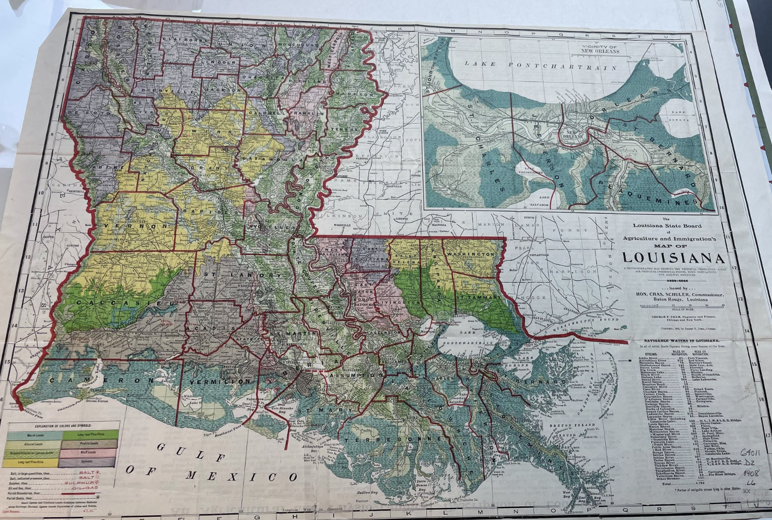 Land cover map of Louisiana from 1909 in the Harvard Map Collection.
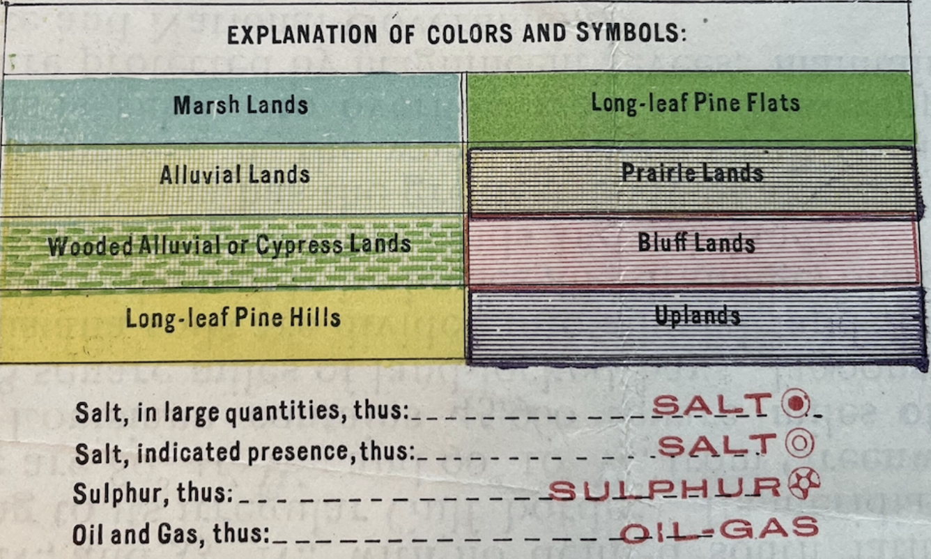 The legend of the 1909 land cover map of Louisiana.
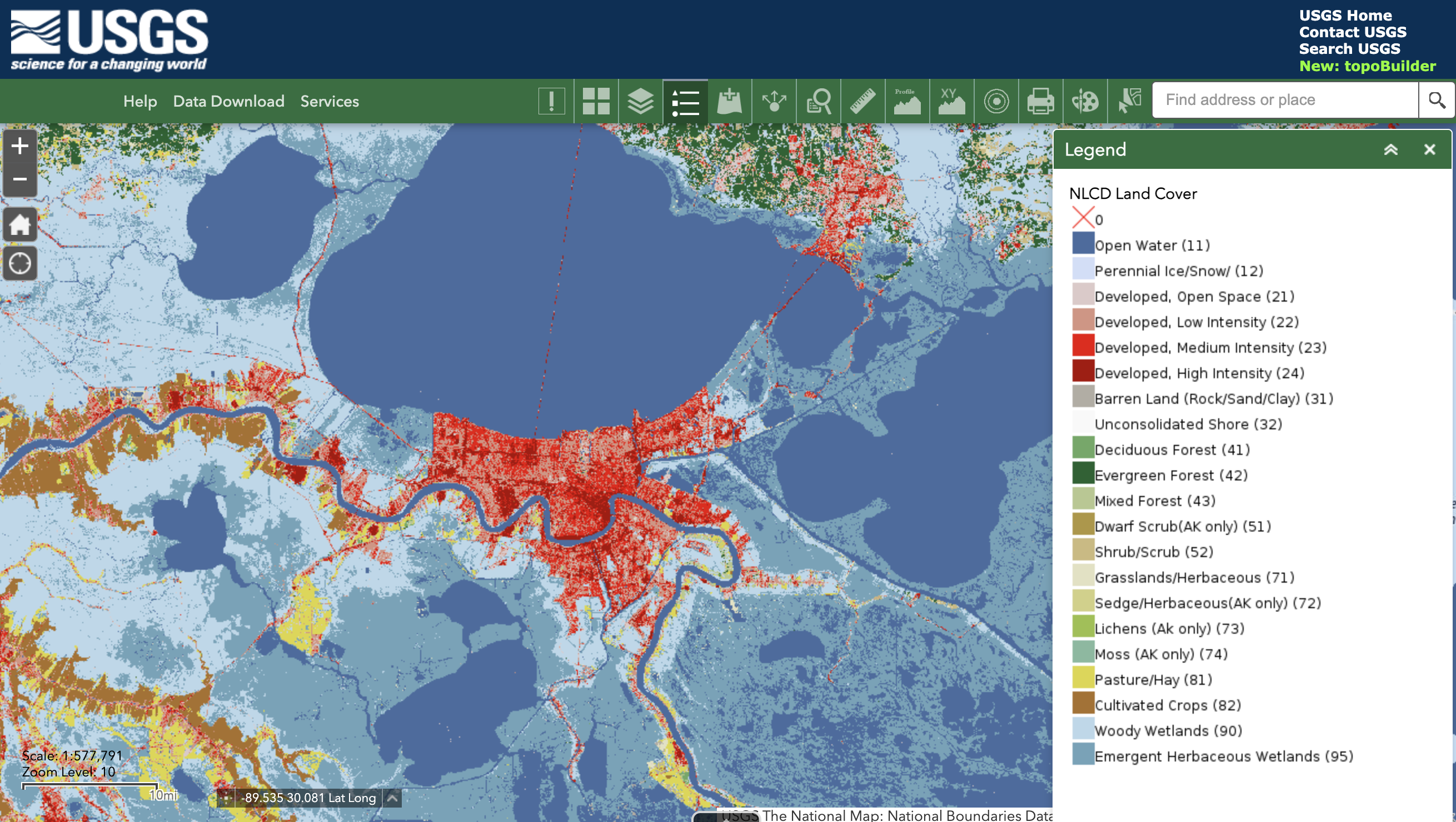 USGS data download tool, showing land cover data from 2016.
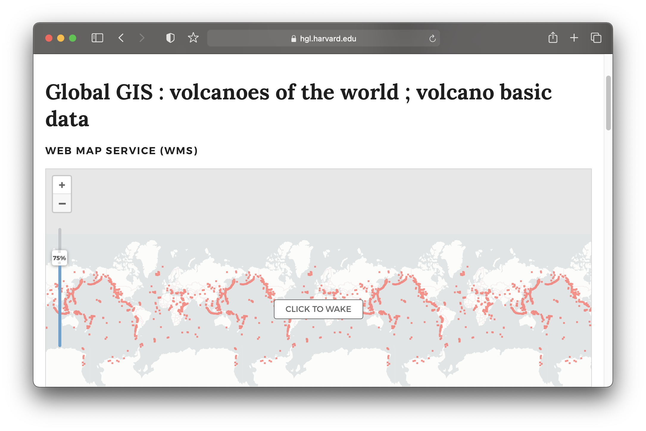 Global volcanoes dataset in the Harvard Geospatial Library (HGL).
Workshops
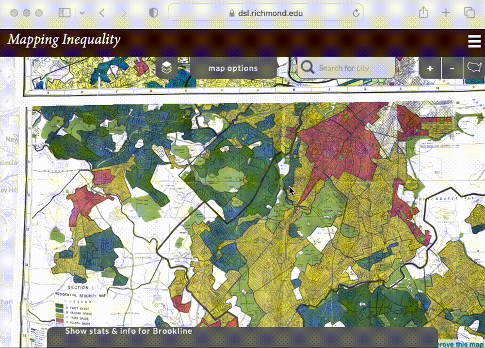 Mapping Inequality project via the University of Richmond’s Digital Scholarship Lab.
 Land-Grab Univerisities interactive digital project.


Spring 2023 workshop offerings. Registration via the Harvard Library Events calendar.
Office hours
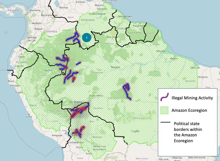
Map created by Luisa Shido.
Tutorials and project examples