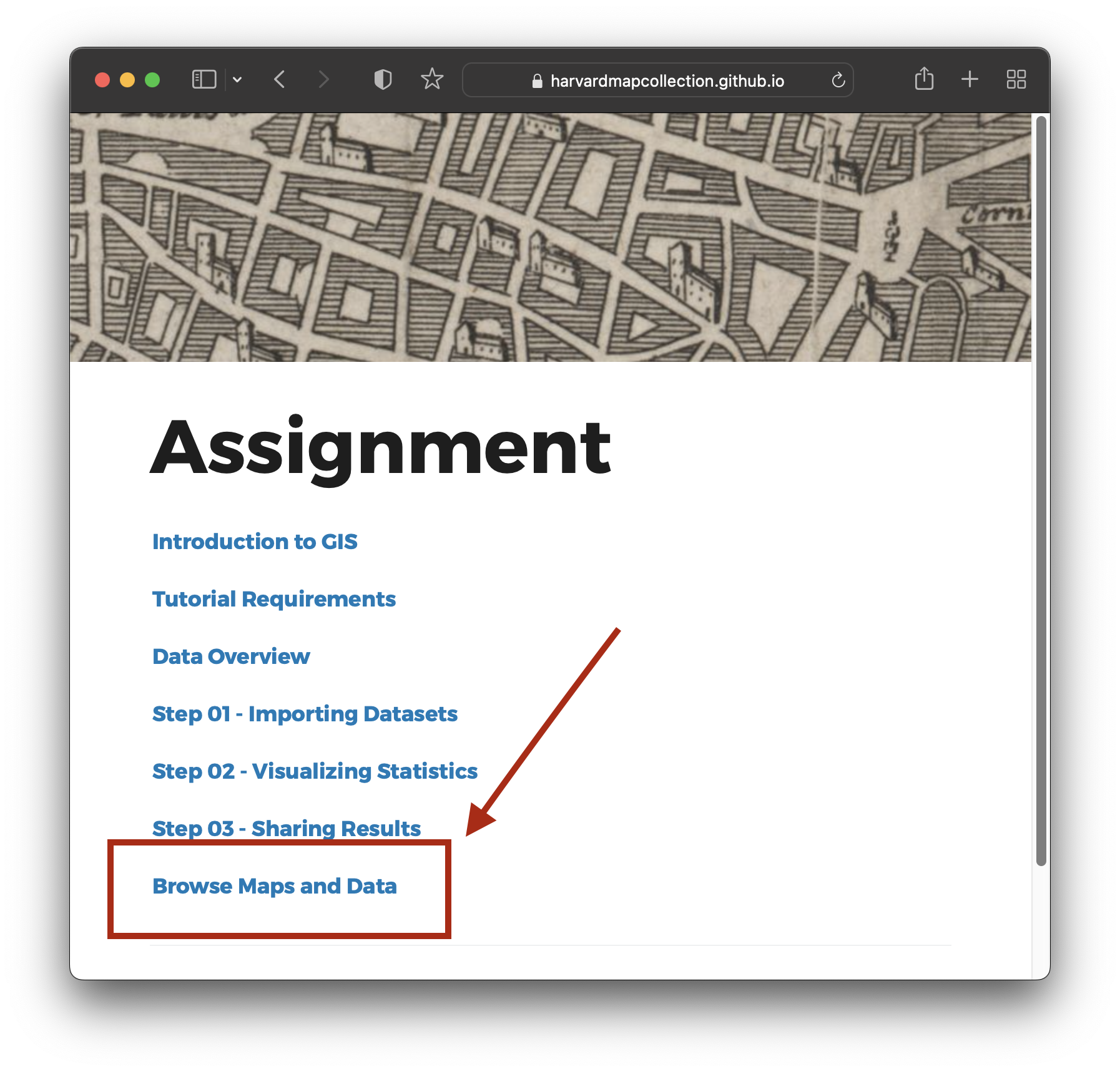
Introduction to GIS
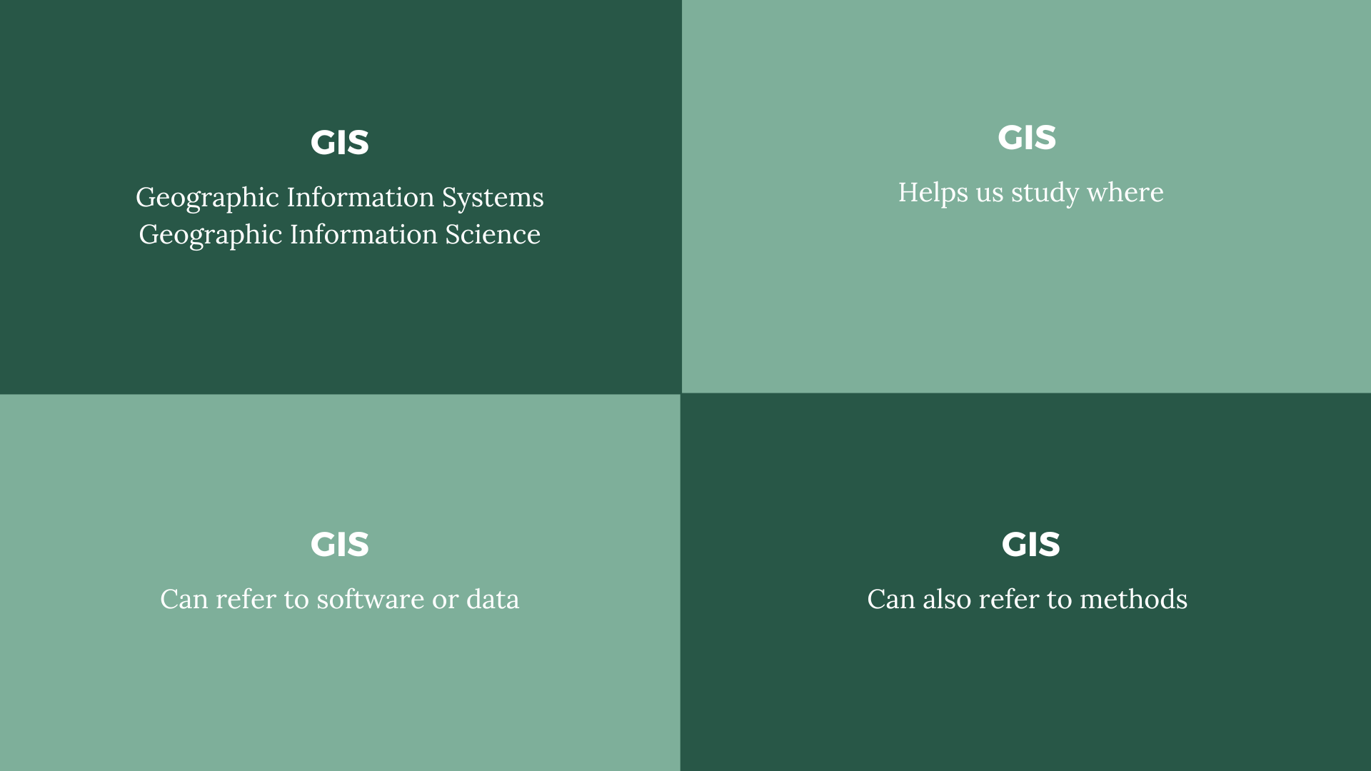 GIS definitions.
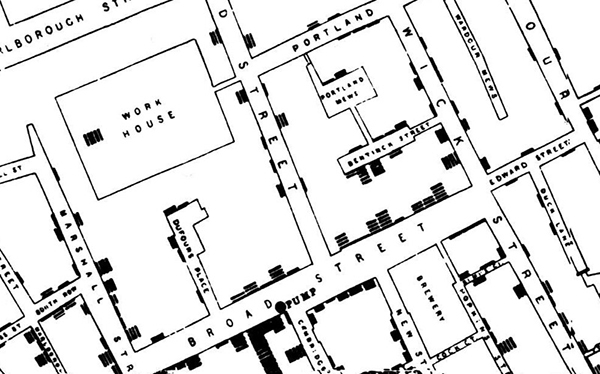
John Snow cholera map, 1854.
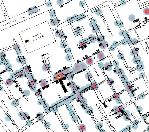
John Snow cholera map, overlaid by a modern-day GIS heatmap layer.
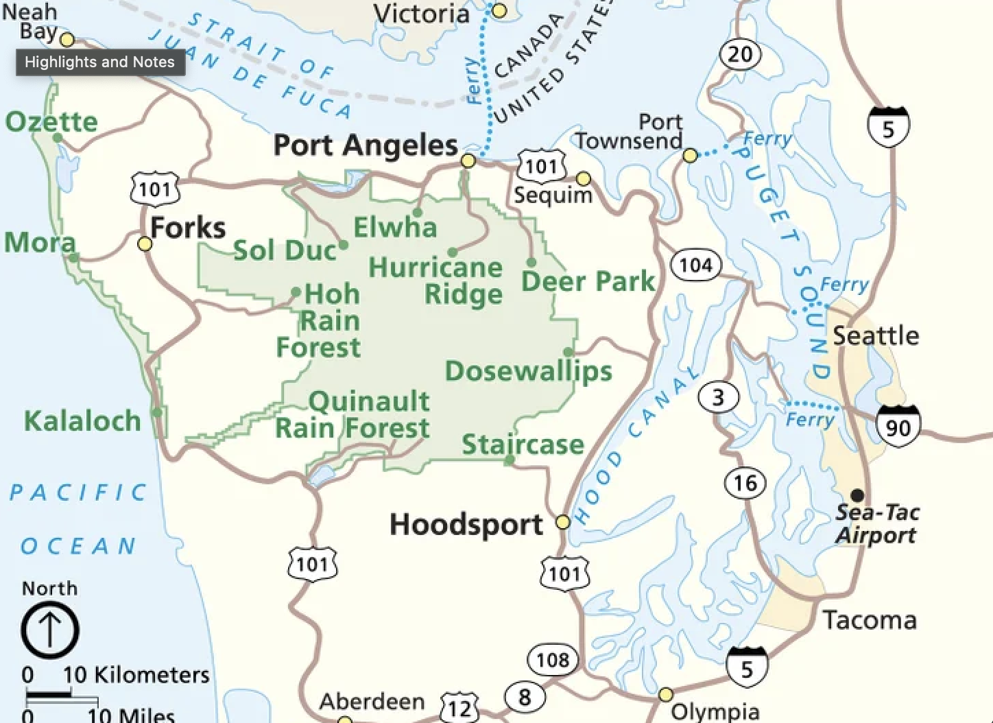 Offical Olympic National Park map.
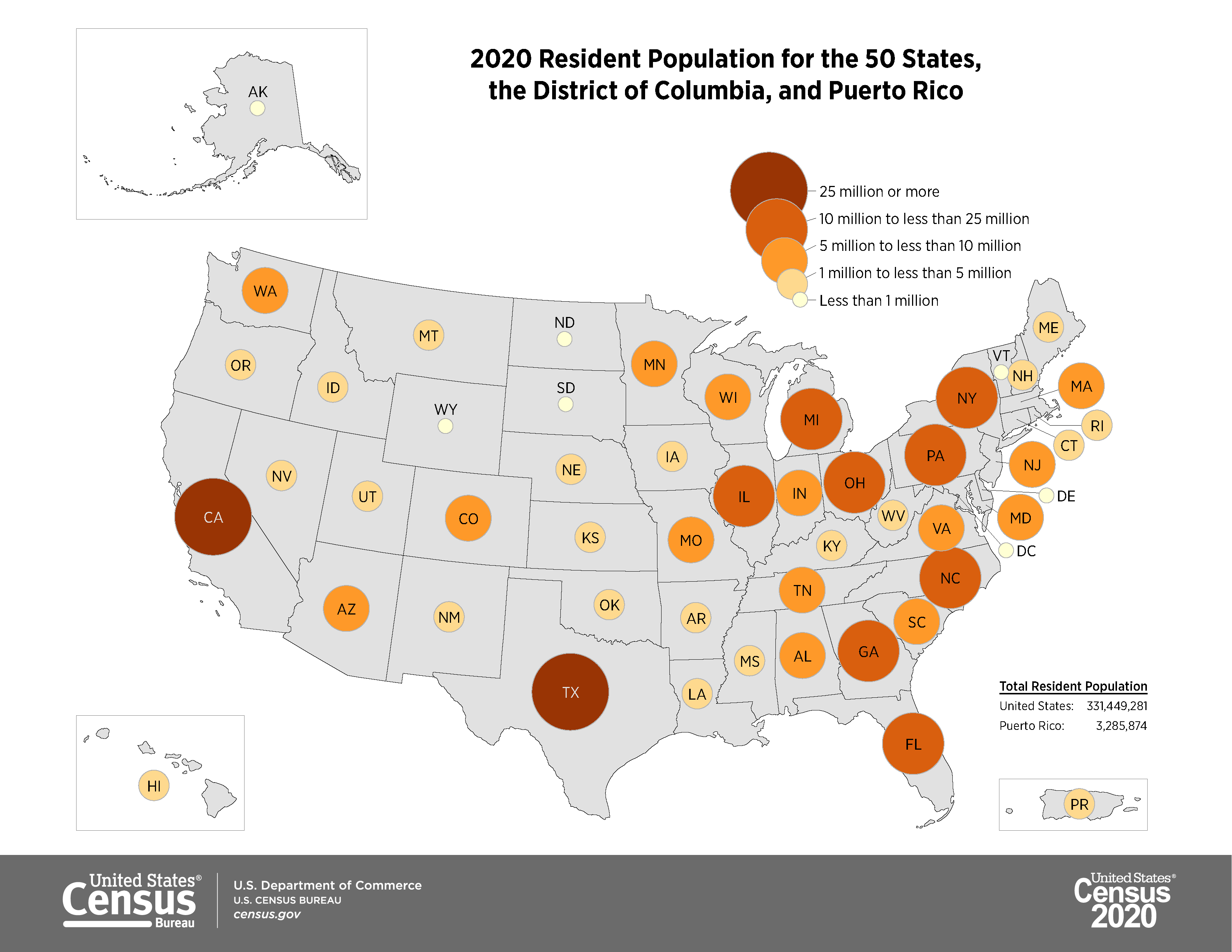 Graduated proportional symbol map showing 2020 population by state in the United States.
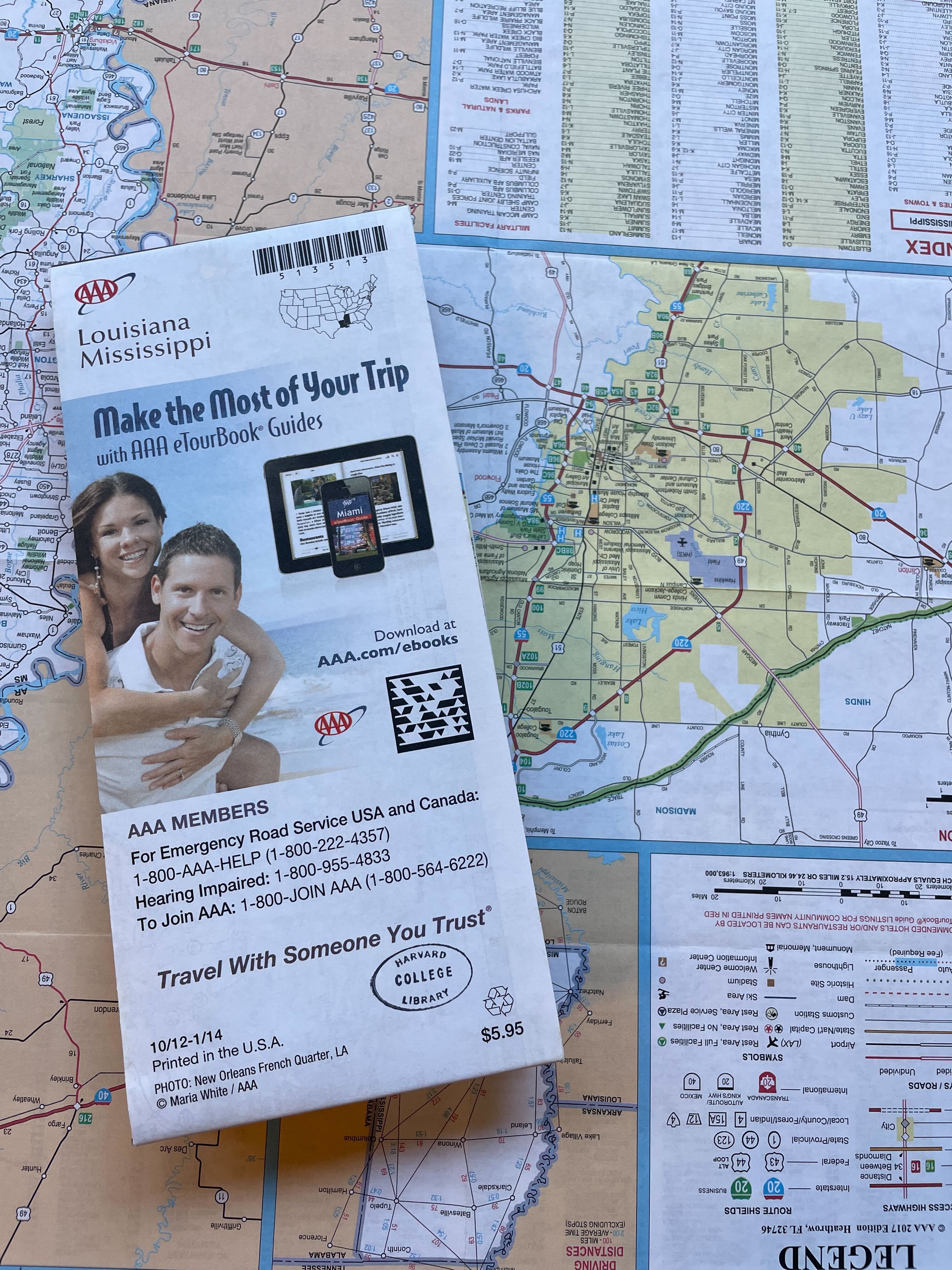 Louisiana and Mississippi roadmap from the Harvard Map Collection.
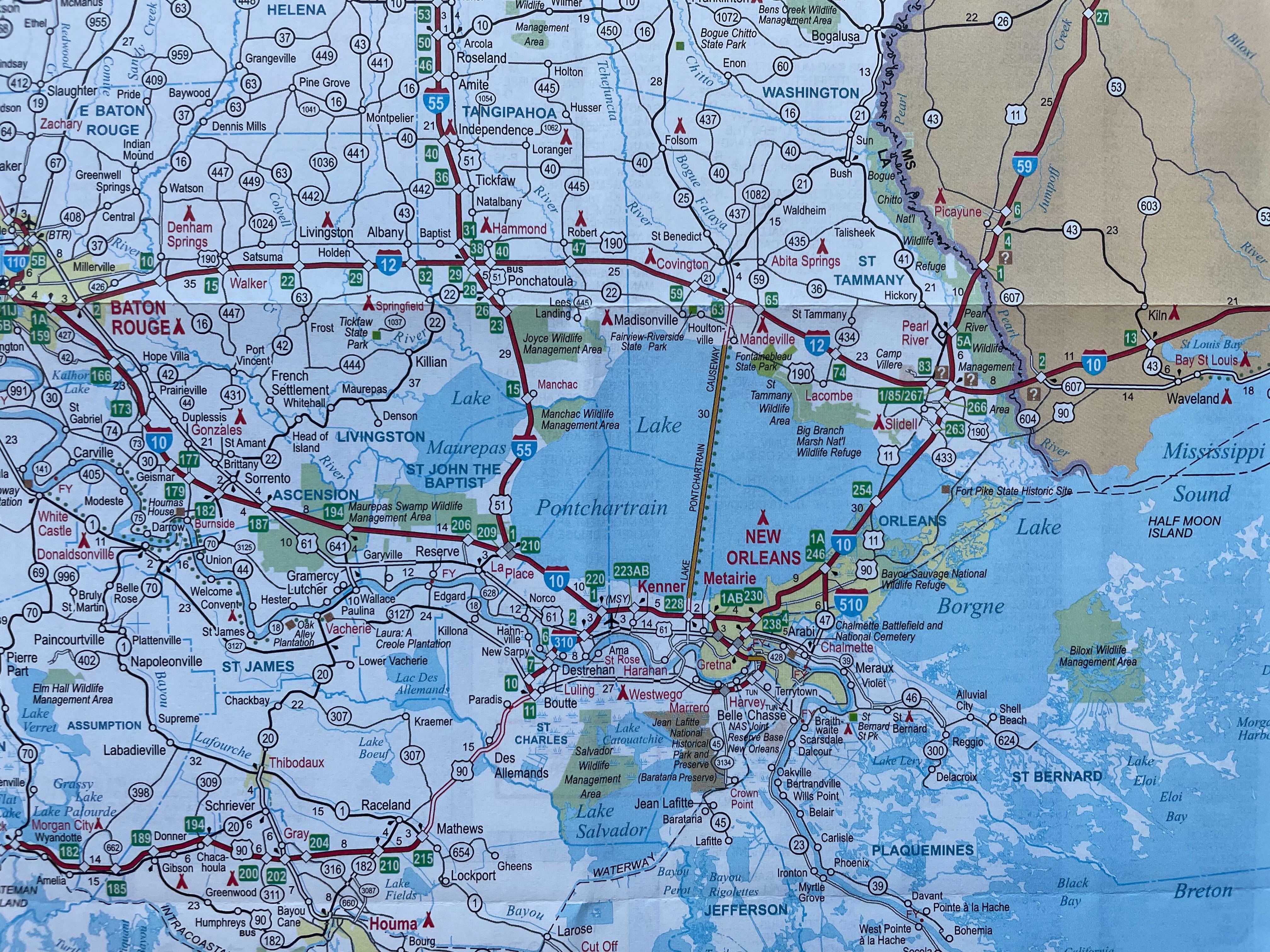 Louisiana and Mississippi roadmap from the Harvard Map Collection showing the New Orleans area.
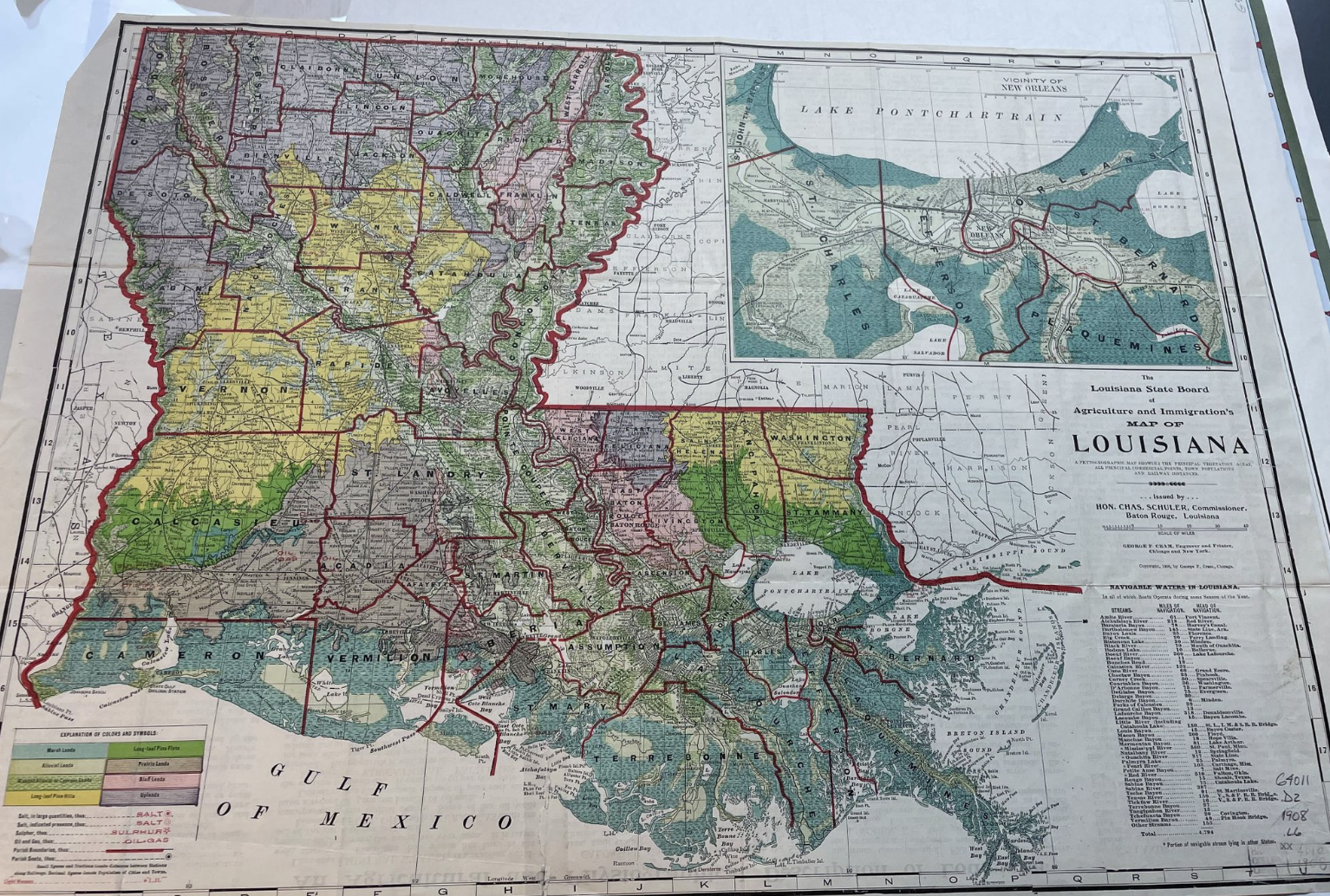 Land cover map of Louisiana from 1909 in the Harvard Map Collection.
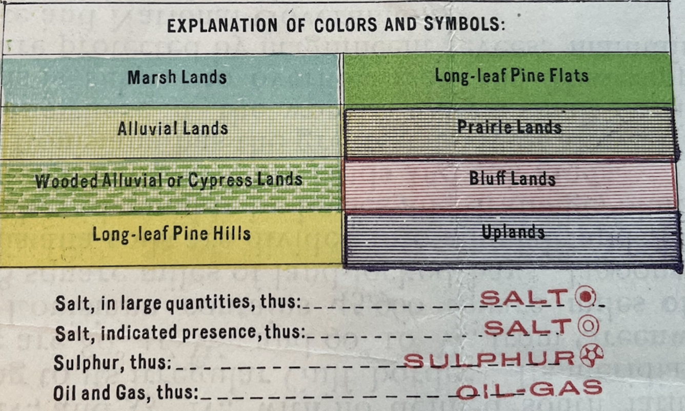 The legend of the 1909 land cover map of Louisiana.
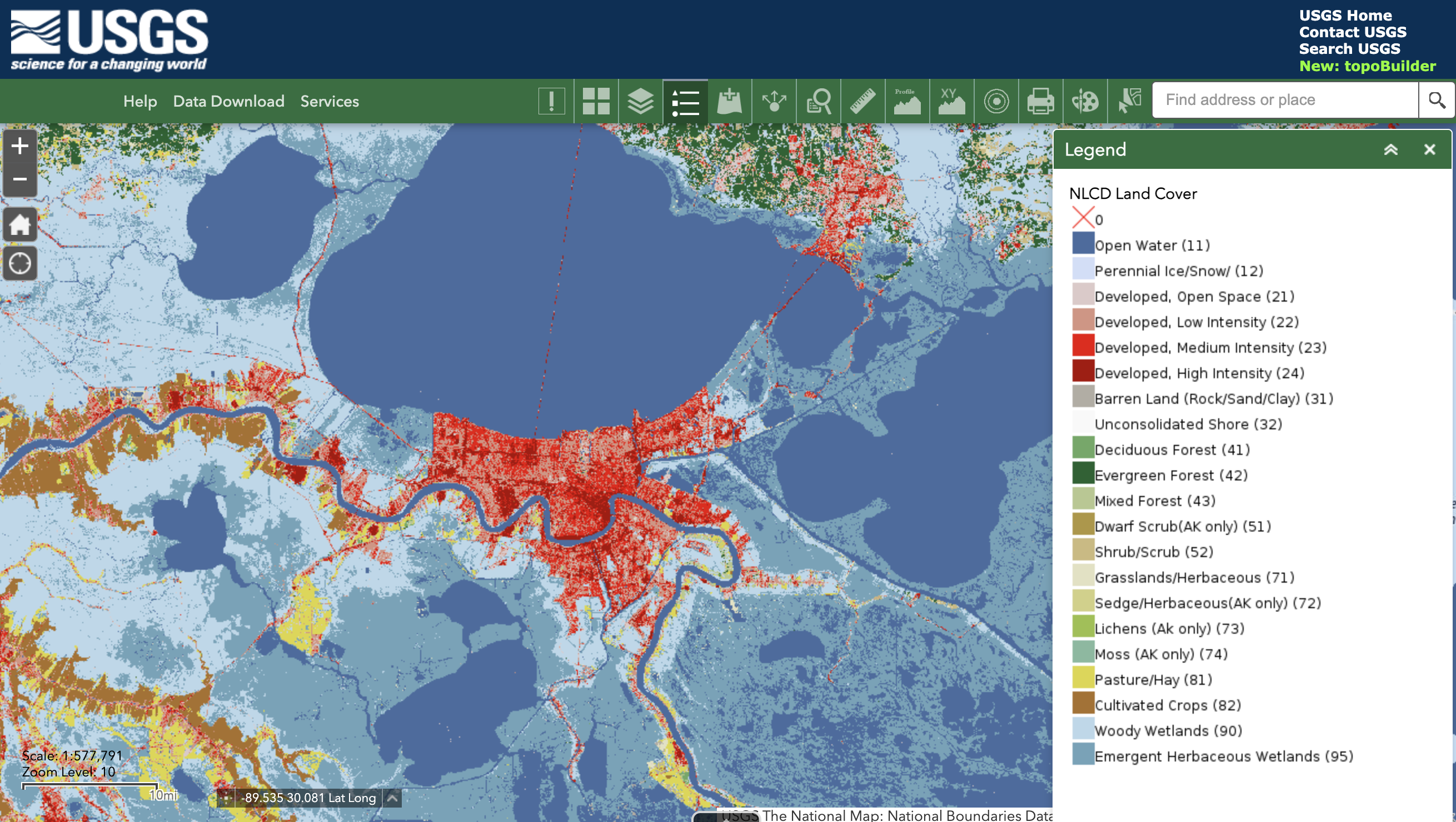 USGS data download tool, showing land cover data from 2016.
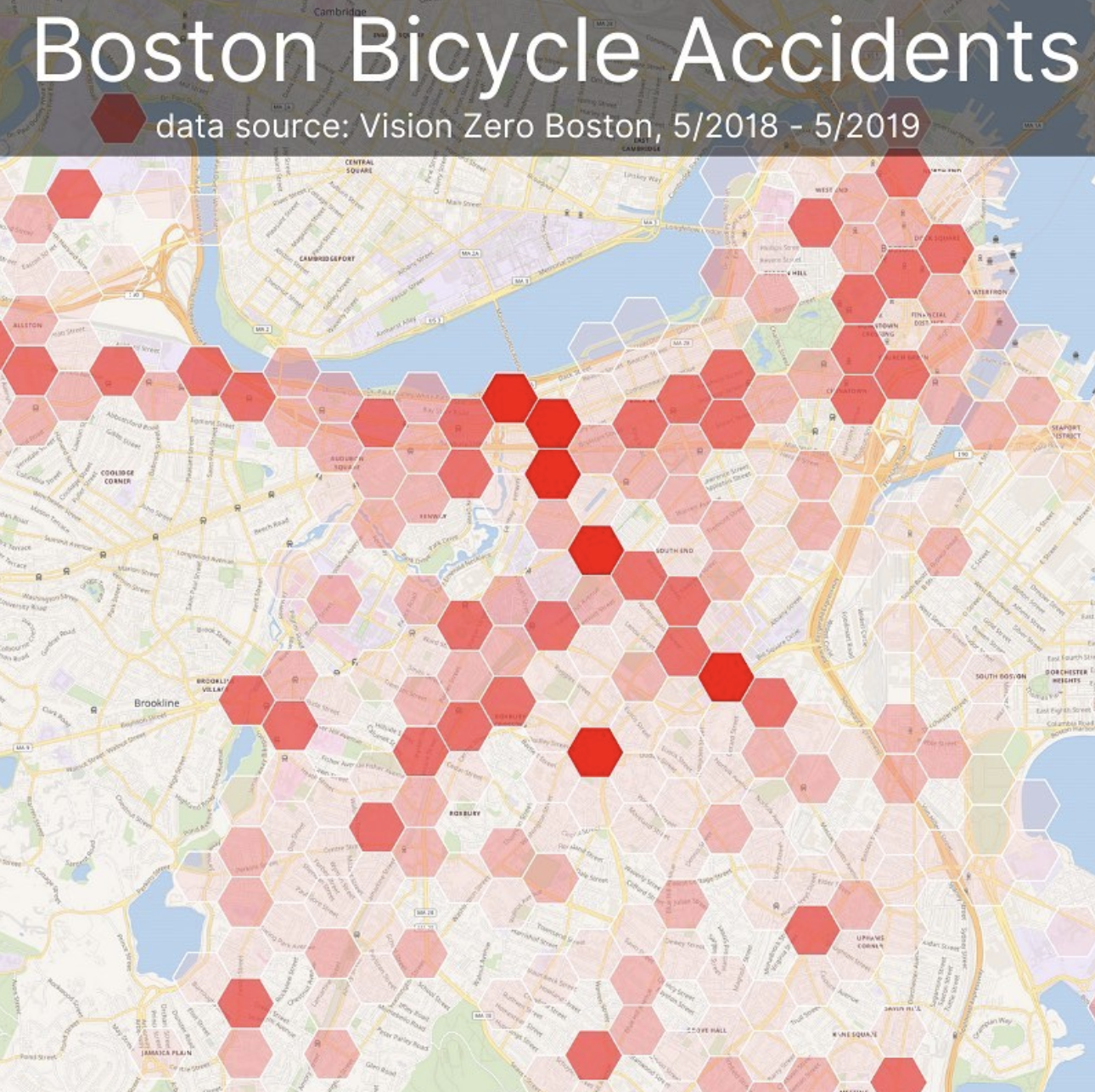
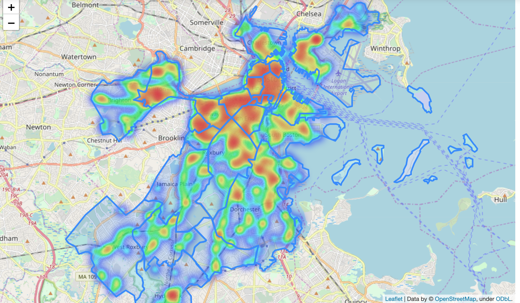 GIS heatmap of density of restaurants in Boston.
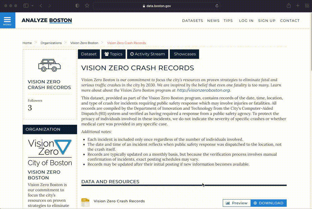 Analyze Boston, Boston’s open data portal.
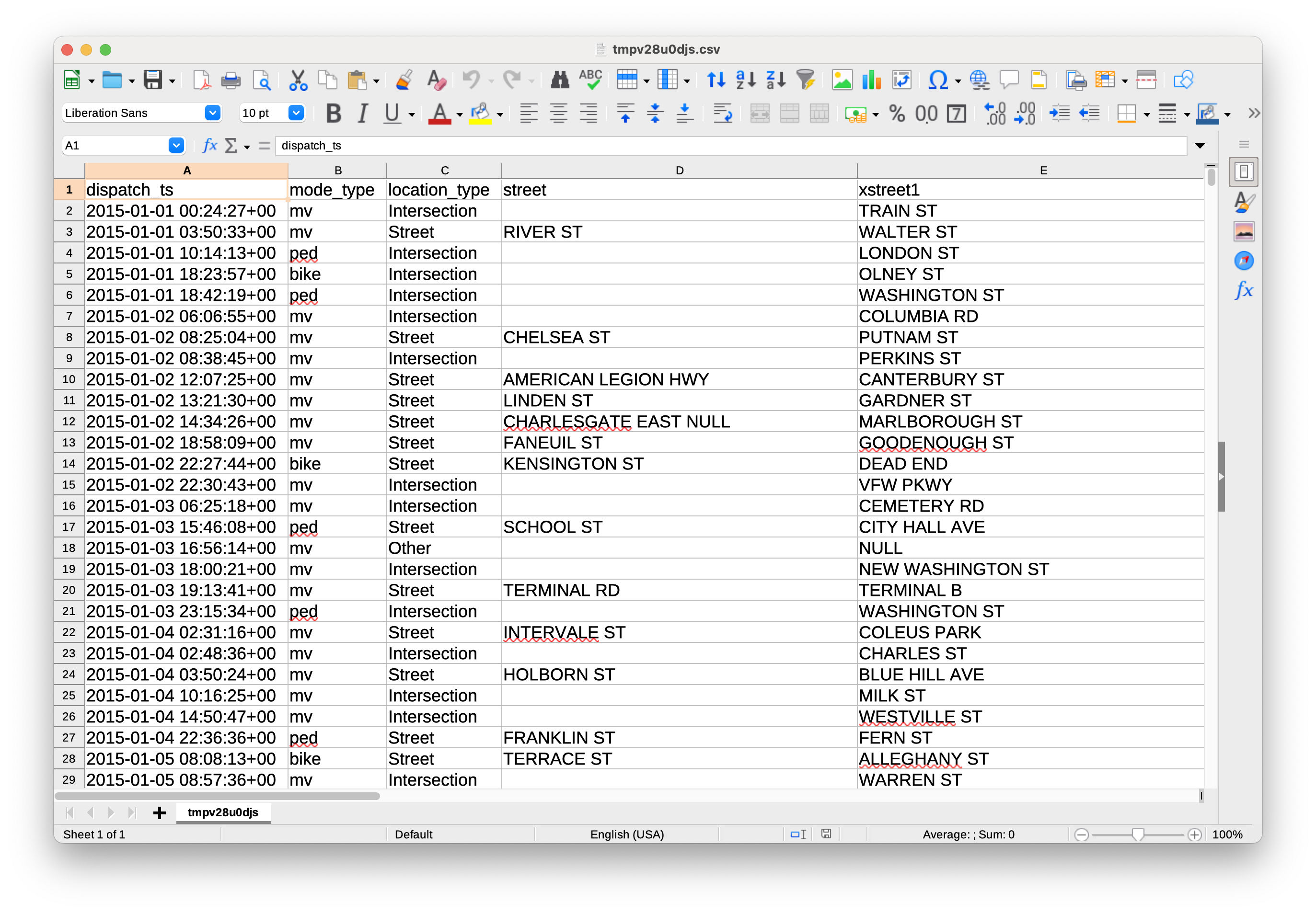 Vision Zero dataset, open as a table.
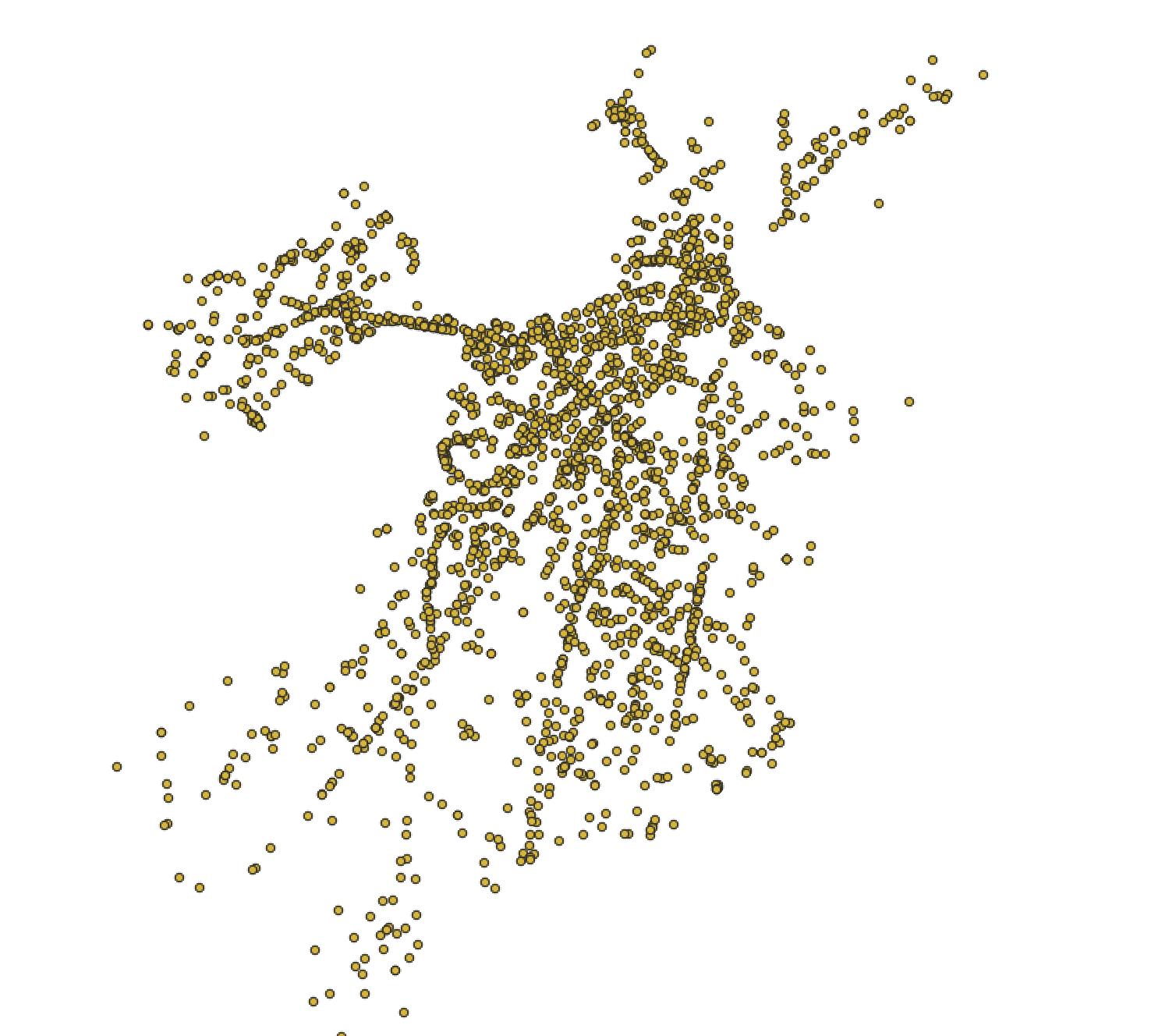 Bike crash data displayed visually as individual points in GIS software.
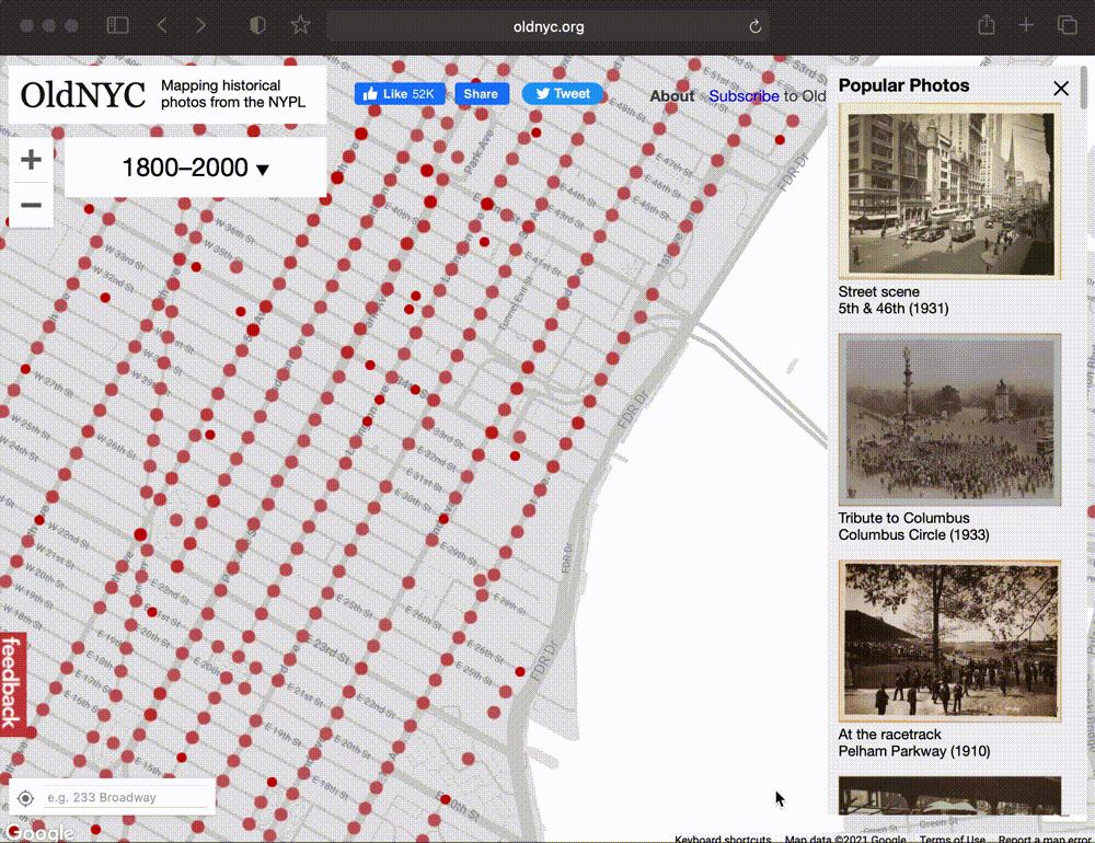 OldNYC: Mapping Historic Photographs at the NYPL.
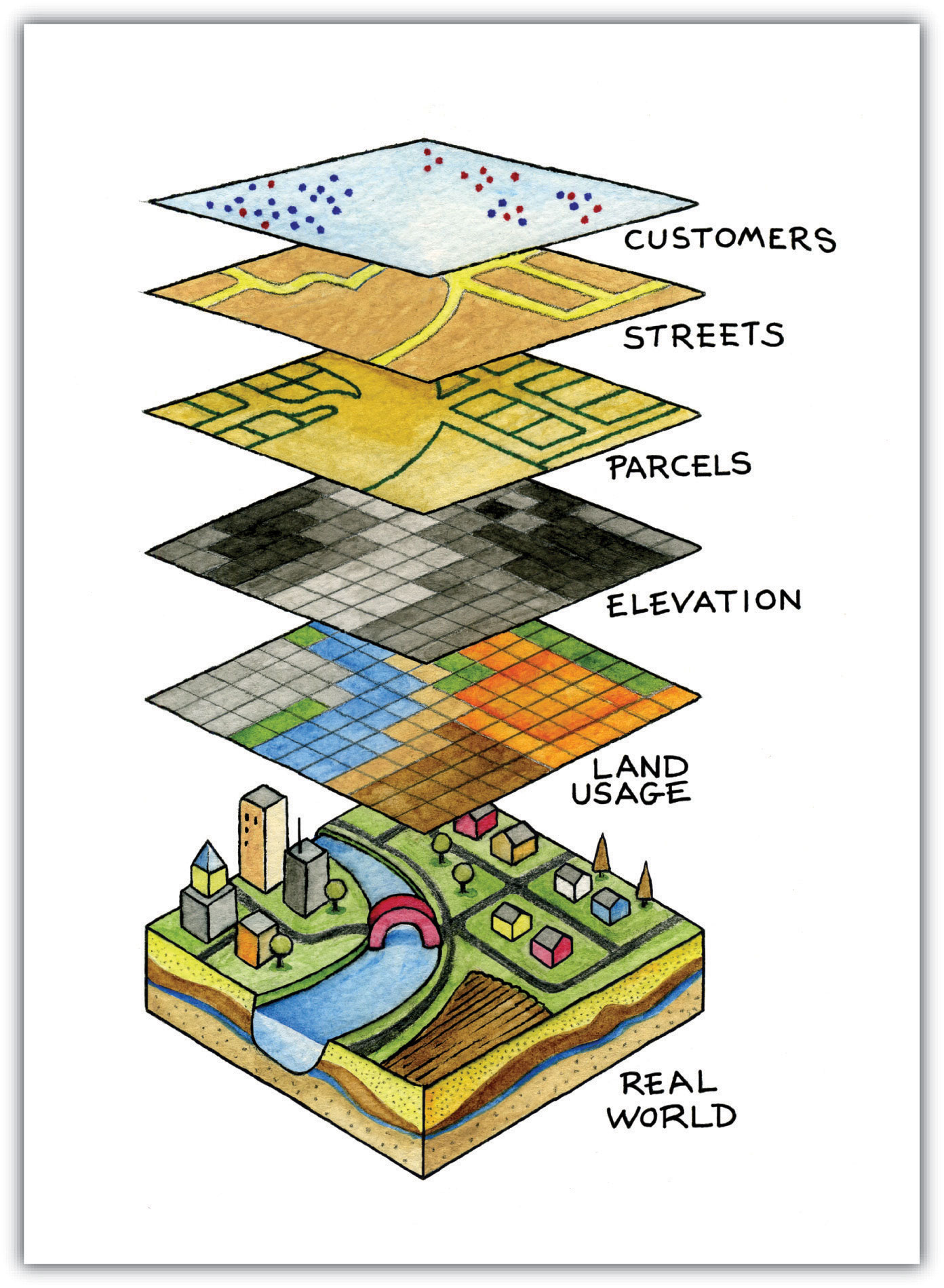
GIS data layers diagram.
 Belle’s house in college.
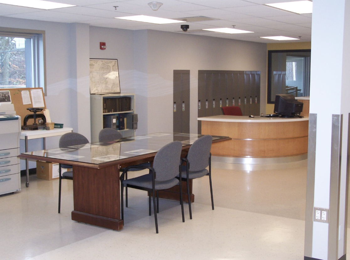 City of Boston Archives Reading Room.
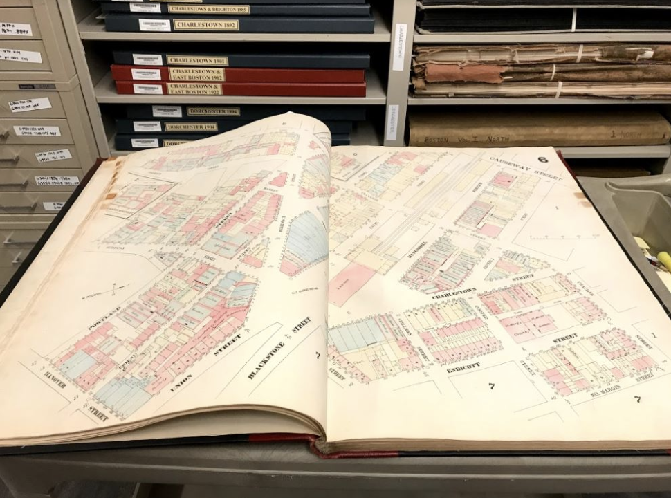 19th century insurance atlas, open to a plate of downtown Boston.
Atlas viewer, Atlascope, a GIS tool from the Boston Public Library.
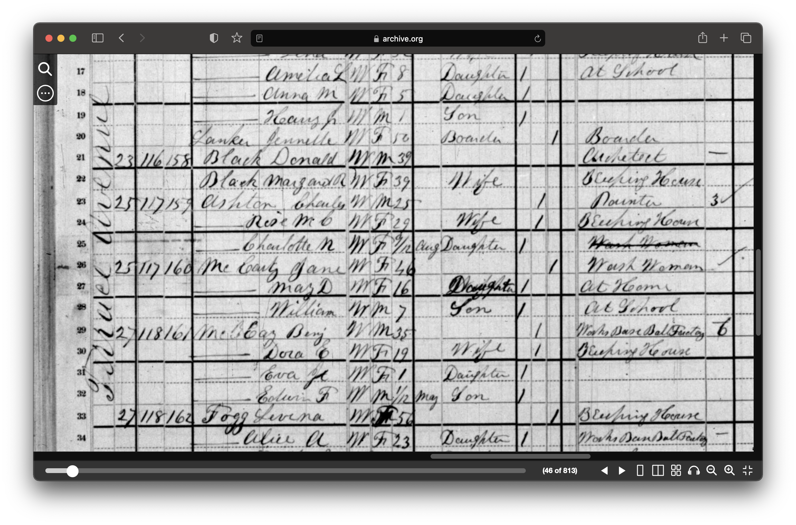 1880 census from Archive.org.
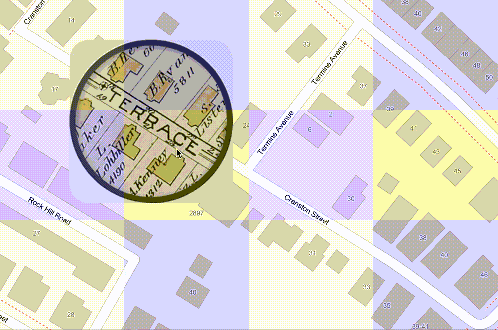 ArcGIS Map comparing 1890 atlas to today.
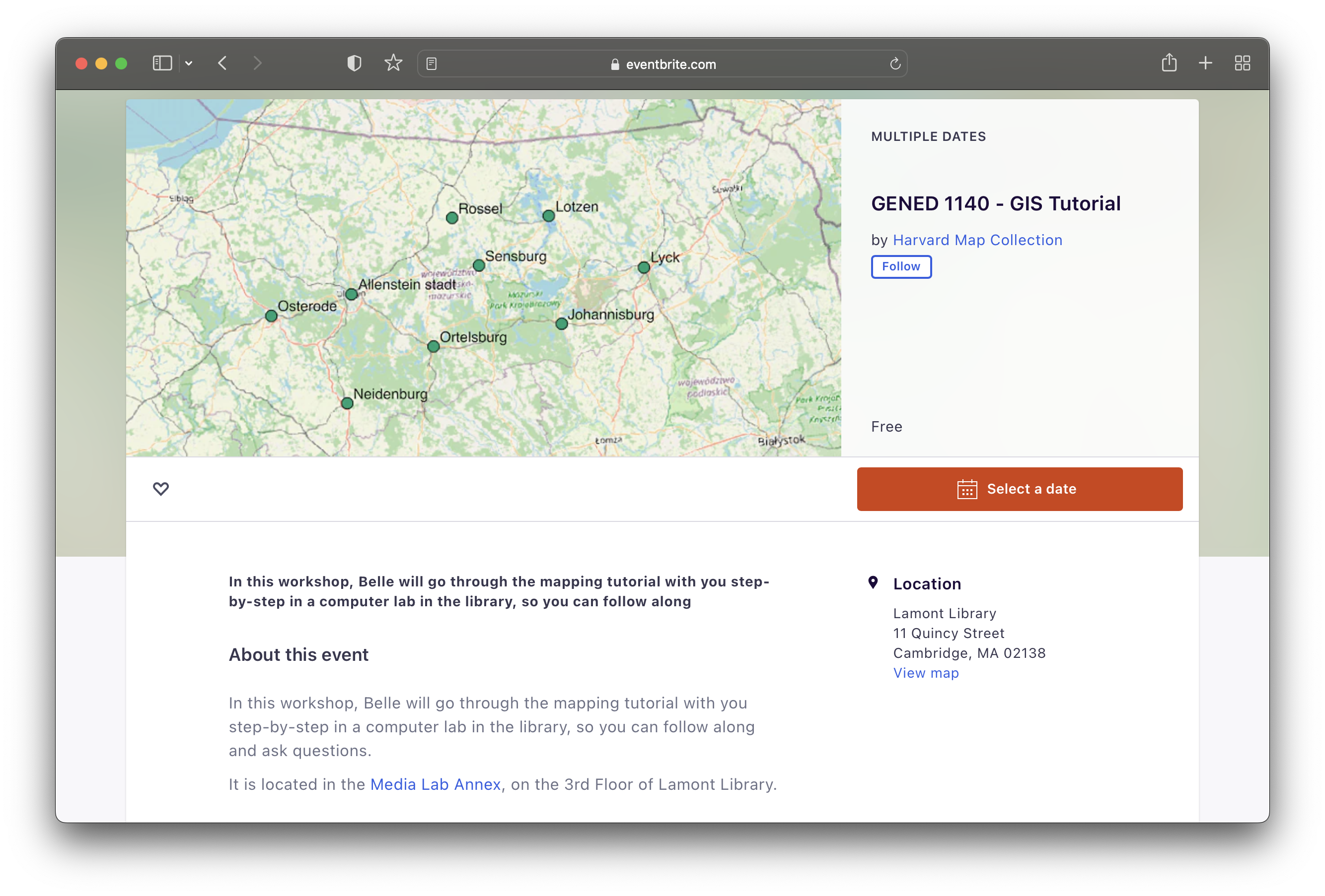
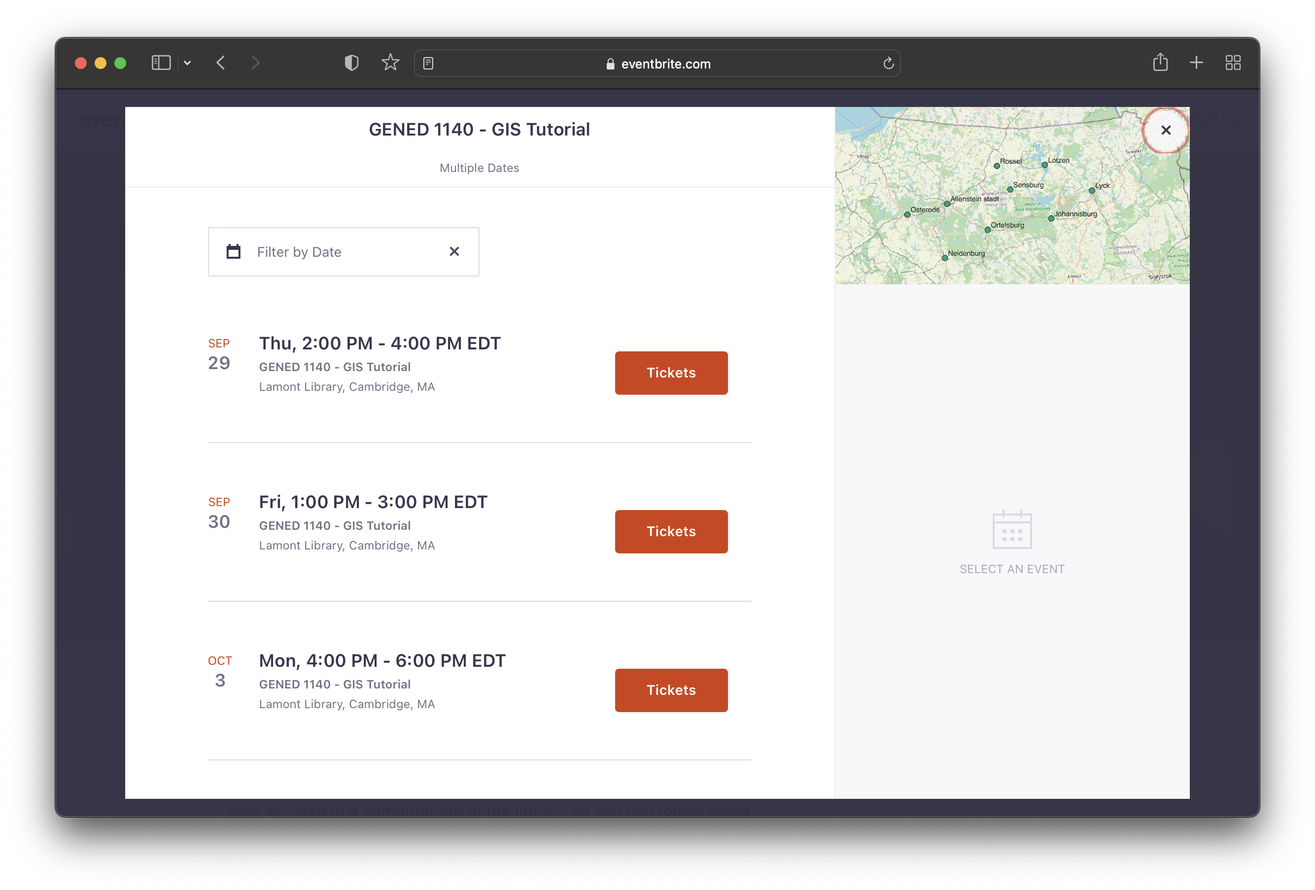 Follow along the GIS tutorial in a workshop setting with Belle signup form.
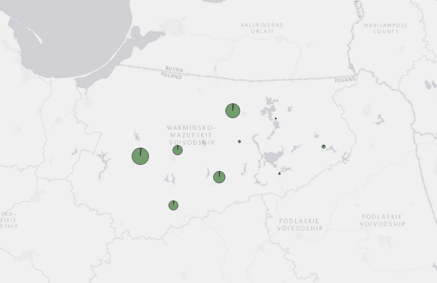
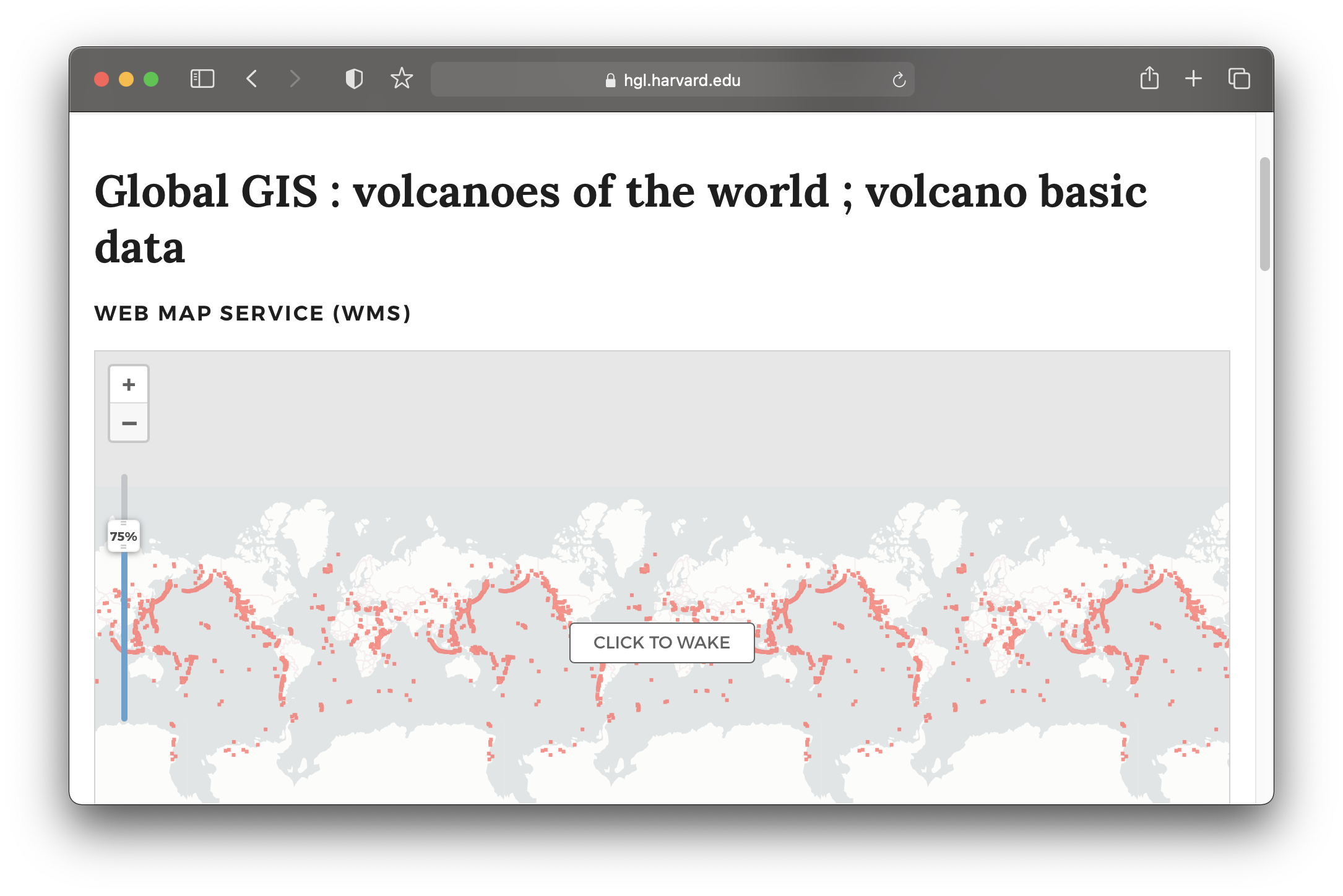 Global volcanoes dataset in the Harvard Geospatial Library (HGL).
maps@harvard.edu
You can contact us at maps@harvard.edu.